
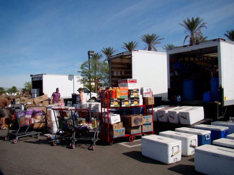
We are in Egpyt
If Zion is adventurous, then Escalante is wild. Escalante Grand-Staircase National Monument was designated with a signature by President Clinton and with that penstroke almost 2 million acres of the most wild country in the nation was set aside to be managed by the BLM. The land has changed little under its new federal designation, though now it has been discovered by adventurers. It is a limitless maze of red and cream sandstone canyons and gulches, slot canyons, 1oo-mile dirt roads, primitive campsites, pictographs and pytroglyphs, springs, creeks, and swimmin' holes. The silty Escalante River is the backbone of the region, collecting the 1,000 year old trickling springs and alpine creeks pouring off the 10,000 foot Aquarius Plateau and delivering them all to the backwaters of the Colorado River forming Lake Powell.

We find ourselves again in the land shaped by the Colorado River. After working for so long canoeing great sections of the lower Colorado River, we feel happily connected to all the water flowing on this grand plateau. For we have seen it further towards the sea and know its future place on the land.
The Escalante is a river, but it is also a place. Though it's not an ordinary place. In the Escalante distance has a way of expanding, water is precious, and the energies of cultures past permeate the land. It's the sort of place you top off your rank and fill up the water jugs before heading out into it. Regular maps will lead to being hot and lost. Compasses become important again. I see it as a wild land, long explored by wild people. 1st the Pueblo and Anazazi, then the Navajo, then the hearty (and most likely crazy as all hell) Mormom pioneers, and now us. Hmm?
We've been driving on rough dirt roads for hours now – haven't seen a soul. We are headed for a desert slickrock bench named Egypt. There we will look for the aptly named Egypt slots. They are a collection on sinuous, miles long slot canyons dropping abruptly south into Twentyfive Mile Wash. We imagine them as damp, shady recesses offering cool routes through the Earth with nary a glimpse at the sky.

We get out of the car again under a hot desert sun. I move rocks, fill holes, get down like a golfer reading the break of the putting green. This is a rough road, it has been rough for hours, and Egypt doesn't seem to be getting any closer. We decide to go for it. The mini-van claws at the gravel and slickrocks. I marvel at its strength in this desert blast-furnace, the engineers back in Japan surely never imagine their Honda Odyssey in these conditions. No one would ever imagine anyone or anything in these conditions. These conditions, this place, can can not be planned for or a machine built for. This wilderness road with not a structure in sight attest to that. We are in Eygpt.

That night we burn a bright, smokeless fire of bone-dry juniper. From our lonely site the desert vista is long, yet there is not another fire or electric light to see. The fire reduces to a smolder and the starlit desert is all ours.
In the morning we pack our bags for the unknown, all the while pounding water and feeling dehydrated. We start down the road, continuing where we left off by van the evening before. A small Toyota truck comes around the corner and it is a weird reminder that other people still inhabit plant Earth. They stop and we climb into the bed of the truck. The road is surprisingly rougher still and we flop around in the back of the truck as its tears at the rubber-smeared slickrock trail. We are in Egypt.

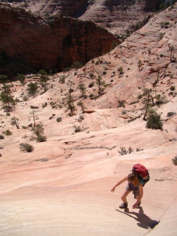
We stand atop the 3rd slot counted from west to east. The landscape below us is another world. Slickrock rules the eye. The sandstone has been swirled and pressed by forces past, then eroded by the sensual yet unforgiving hand of water. There is little vegetation and its hard to focus because of the depth and distance in one frame.
The slot is cool and narrow and dark. The bottom is sand and mud, but the walls are hard and sometimes smooth and sometimes rough. We turn sideways , dragging our backpacks behind us. Michele is having a blast because her shoulders fit through almost every squeeze straight-on. I turn to the side and suck in my stomach. The sandstone is all around us – it is comforting but unnerving at the same time. Water has indeed carved this place; best not to think about the how's and when'snow.
We are blinded and melted as we are spit from the bottom of the slot. There are murky, tannic pools of water that we purify and drink. We are in the desert wilderness. The Toyota truck is long gone, our van (thankfully full of gas and water) is 2000 feet up the slickrock that forms our backdrop.

There are no trails in Egypt. There are no bushes or trees to warrant them. You can walk anywhere. A good map and a compass tells you where to walk. We take a bearing and follow it blindly (like in a snowstorm) up and across the tan, and peach, and maroon ramps of rock. It is afternoon and the sun is at its fullest potential. We weave through patches of cacti and sand; we marvel at our posistion on the land. We begin to call it: open desert. Because that's what it is. No water, no trails, no shade, no people, no informative brochures, no shuttle buses running on propane and bureaucracy. Nope. We are just walking on a bearing of 285 degree NW in open desert. We are in Egypt.
Photos: 1)Michelle plots the course for the day. Egpyt 3 below 2)They don't call it Grand Gulch for nothing 3)hiking slickrock 4)Wildflowers everywhere this spring 5)Native rock art along the Escalante River 6)I'm not really stuck, but I could be, Egpyt 3
 Then the sun came out. We went to the river. No one was there because it was cold. The trails were melted out and there were great blue heron and mallard ducks and beavers.
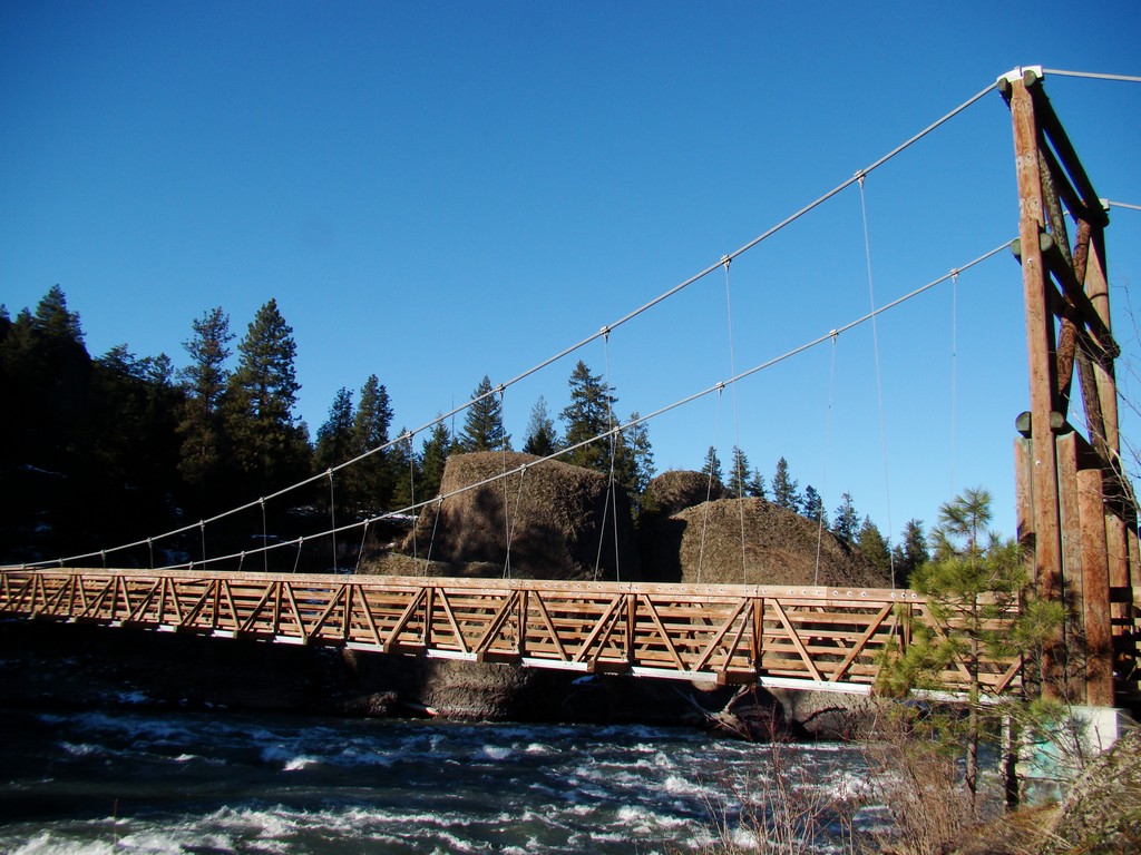
 The swinging bridge above the rapids was sitting in a sliver of winter sun. It was warm and shiny and smelled like old railroad ties. You could feel the cold air coming off the river and mixing awkwardly with the sun warmed pines. Back in the tress, leaving the river, we dodged puddles of black ice, and it was bitter cold. The sun had gone down.


