Friday, March 07, 2008

Out of Bend and headed south

We'll the winter season, for us, is over. I write to you from Bishop, California as our annual California spring begins. Bend, over the last few months, was nothing short of insane and Michelle and I both look forward to another Central Oregon winter. But for now our list of upcoming spots on the map is growing.
Look for reports from Bishop, JTree, Ventura, Pinnacles, the North Cascades, and all spots in between.

I am also excited to announce the upcoming audio podcast of IanOutThere.
Look for it soon at: podclimber.com


Thai monkeys will have to suffice til then.

Saturday, January 19, 2008

Winter, winter, winter


It's been a couple of eventful weeks in Bend with winter coming from all directions and in all shapes and sizes. It's been real snowy, then real cold, then real nice and spring-like. The winter here in Bend can't be figured out but that hasn't stopped us from getting out into the wilderness wonderland of Central Oregon.

There a lot of pieces to put together to make it all happen but the recipe for adventure reads pretty easy. Chase the snow on the hill, pick the sunny days for backcountry, climb if it has been cold. This is what we came up with after we put the whole thing in the oven.

Hoodoo TeleFest last weekend, Todd Lake backcountry skiing Monday, Mt. Bachelor perfect pow Tuesday, the amazingly comfortable Mountain View Hut Wednesday through Friday, and ice climbing Paulina Saturday.


Photos: Ian following Big Paulina. Eric Harvey sending his very first ice climb. The view from the window of the shelter (3 Fingered Jack). The odyssey pulling the Ghetto Rocket, Michelle gearing up.

Sunday, January 06, 2008


New Years Day 2007


Paulina Falls -
Newberry Crater
National Monument


I've been wanting to climb this for years. After a week of single digit temperatures reported at Sunriver Paulina Falls seemed finally probable. It was New Year's Day and the sun was out. The temperatures were climbing back above freezing making the well-formed ice sticky and fun. Josh and the Harvey team had already beat us up to 10 Mile Sno-Park and had made a quick snowmobile reconnaissance up to the falls to confirm it frozen and steep. Michelle and I attached the GhettoRocket to the back of the minivan and slid our way down 97 and up out of LaPine. We loaded more gear into backpacks, unloaded another snowmobile, and headed into the crater (at 25MPH).


From the snow-buried tourist viewpoint the falls begs to be climbed. I splashed across the top of the creek, potholed through some deep snow and was soon stomping out a platform and planning an anchor. Josh joined me at the ledge with crampons on his feet and axes in his hands. He rappelled into the freezing mist first. It was loud and wetter than expected at the base of the icy face. Josh wasted no time, took a quick glance around at the alien icescape, turned back around and sank an ice tool into perfect solid ice. Within minutes he emerged at the ledge, hardly out of breath.


For me it was a bit different. Ice tools felt foreign in my hands, crampons were not the normally comfortable sticky rock shoes. I made wild rock climbing moves with legs splayed and arms over reaching. I set the pick in the ice well, too well, and worked hard to removed it for the next placement. I emerged at the ledge at well, breathing hard. The sun was setting. Josh brought a beer. We drank it.


Tuesday, December 25, 2007


Michelle skins to the summit of an unnamed butte on Tam McArthur Rim; Broken Top in the background. Three Sisters Wilderness.

Saturday, December 22, 2007


Finally....


It's been the longest hiatus of IanOutThere yet. I've heard from enough folks from afar - nows the time to, again, start putting some pictures and stories up for the world to see.

For those I haven't caught up with lately, Happy Winter!

Michelle and I are 'holding it down' in Bend pretty well so far. After a slow start to the ski season the last week has been a non-stop snow storm at Mount Bachelor. The roads have been icy, the mornings freeeezing, and the white stuff bottomless; just how we like it.

Our first month in Bend has treated us quite well. We have a nice warm house in SE suburbia with a extra room with YOUR name on it. Bring your boards.


1)I titled this photo of the Sisters: the why. And if you'd been there on the day I shot this from the summit bowl of Mt. B you'd know why too.
2) Still untracked - I Sneak a couple turns through the wind-pack in Rainbow Bowl. 3)Don't forget the motorized winter fun this season. The Harvey's don't!

Thursday, October 18, 2007

Owens River Gorge
Alabama Hills
Malibu Creek State Park
Colorado River
Las Vegas
High Sierras
Mono Lake
Ventura Surf Sites
El Capitan State Beach

Sunday, August 05, 2007


The Canadian Northwest Quicktrip

Rivers- Elk and Vermillion
Mountain - Ghostrider
Climbing Area -Grassi Lakes
Hot Spring- Lussier
Parks - Banff, Kootenay, Yoho, Whiteswan, Elbow


Photos: 1) The Odyssey makes its way down yet another gravel road in search of rock and river routes. 2)Banff NP classic too-close wildlife encounter. 3) Michelle waits at a gravel bar on the glacial Vermillion River, while I scout yet again for a route through the braided ripples and endless logjams.

Monday, July 30, 2007


The Road to the Rockies

We started the last week with two amazing canoe adventures near Spokane. The first was a short evening trip down the Little Spokane River where we had a close and a bit nerve-racking encounter with a momma mouse and a newborn. The second was down a little known stretch of the Pend Orielle River with amazing wilderness camping and scenic big river paddling (get a boat, go here, it's great). We entered Canada that afternoon and made break for the Rockies. Bigger mountains, expensive beer, nice people. We're just getting started up in the north country, more photos to come. Thanks for visiting.


1) Michelle descending the ridge from Ghostrider Mountain (2340meteres). Fernie, British Columbia.

2) Rest break on a mid-river sandbar on the Elk River (I+).

Wednesday, July 25, 2007


The Making Of The

OdysseyCamper


1) Square steel tubing sparks as I cut.

2) Harvey welds a corner together. This photo may have fried my camera's LCD screen.
3) The gloss black frame awaits its wood top in its new home.


Sunday, July 08, 2007


Bend In The Summer


  1. Sparks Lake Swimming Hole
  2. 36 miles on the Deschutes
  3. Enjoying the new van on Cascade Lakes Highway
  4. Wakeboarding! Thanks Harv.


Monday, June 04, 2007

Meltdown
August 10, 11, and 12

We got our tickets, you should get yours at:

www.summermeltdown.com

Monday, May 28, 2007


Welcome, welcome. Thank you for stopping by. So sorry it's been so long.

We are working in the mountains.

The Sierra's are no better place to play for your living.

Just a few more weeks before we chase the nice weather to the north. OR, WA, BC, hooray!

Photos: 1) Bristlecone pine forest; this tree is over 4,000 years old. 2)Just one more Sierra glacial valley.


Saturday, May 19, 2007


Yomsemite Slabs


Sierra Mountains


Joshua Tree Granite

Sunday, April 22, 2007


Lately or

Spring in California


Lately I've been busy. Busy working. But it's not work at the monotonous grindstone that sucks the life from you. It's constant work, outdoors, in the wind and rain, with students and friends, in some of the most beautiful places California has to offer. It is 7 days a week. It involves big weekend drives (or boat rides). We are often tired, muddy, cold, up too early, sore, sleepy, eyes full of sand, dehydrated, numb, annoyed – I love it.

Weeks go by quickly. Outdoors constantly, we move at a different speed. No faster, nor slower, but different.

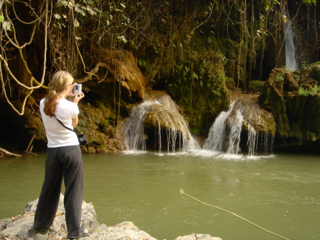
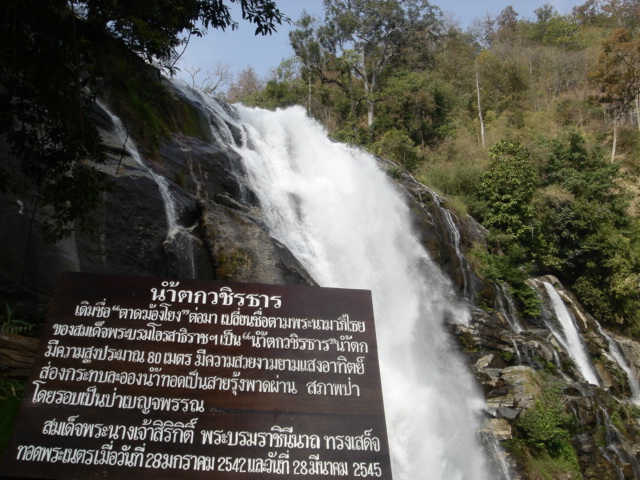
Naturalists At Large has become a comfortable home throughout the entirety of California. Already this season we have braved the harsh spring elements and floated the lower Colorado, explored the empty beaches of Catalina, and relaxed under Joshua Tree starry nights. Needless to say I have stayed far away from the trappings of the computerized world and the blog-o-sphere of the 21st century has seemed so distant and insignificant.


Photos: Checking the weather radio for winds; Taylor Lake, Lower Colorado River.

Michelle sneaking in a well-deserved break; Catalina Island.

Band practice N.A.L. Style; Pinnacles National Monument.

Sunday, March 04, 2007


The image of tropical jungle fruit jumped out at me as I scanned through the photos today.


Surely, the cold grays of northeast washington added contrast to the photo from outside the window.


Freezing fog, decending from the PNW wintery cloud mass would, without-a-doubt, finish off these sweet southerners.


I was worried the jungle fever had gotten to me.
Then I remembered, I was merely a visitor in the tropics.


We are skiing again tall firs and pines of home-
faring well amongst the icy forests of the north.


Thursday, February 08, 2007


Note: In just days we'll be touching back down on Californian soil so I figure I should round up the last part of our roadtrip, though I will surely post much reflection and photos from the last three months once back in front of my familiar Viao. Thailand has prompted many thought proviking questions and ideas within my own head I will share them on the blog. Thai politics and healthcare and food and city-life have all been enlightening experiences for me and I hopefully will touch on all those and more in future blogs.

1000 kilometers continued... (Part 3)
Switchbacks, wilderness, and tourist towns

After the action-packed first two days of our trip we found ourselves worn out by the constant back-to-back new experiences. Doi Inthanon had been such a roller-coaster of emotions and travel - going from natural scenery, to guided hikes, to hill-tribe villages, to rough driving can easily make one day seem like three - so the next day we stuck to the winding yet paved route across many small ranges of tree-covered mountains. Villages were sparse, the road was in surprising good shape besides the frequent construction zones where no flagger or sign stood to tell of the forthcoming danger. Many times we dodged large construction machinery and a motorbike carrying an entire Thai family simultaneously. We took two small side roads to explore viewpoints and a developed, though natural, hot spring that the Thais were using to boil eggs. We broke our own rule and drove the last hour to Sappong in the dark weaving through construction barriers and makeshift bridges. We found, in a newly developed tourist area coined the "wilderness adventure center" a quaint and tasteful bamboo and wood bungalow complete with hot shower, western toilet, and fluffy bedding. It set us back 500baht ($15) and attested to the amazing comforts one may live in while in Thailand. For the entire trip we have teased that we had finally made to the middle-class; of course it required a flight half-way around the world to get there.

The next day we followed a recoomendation in the Thailand Rough Guide (a rarity) and went to find the Cave Lodge, rumored to have fresh baked goods and helpful maps of the limestone region in which we roamed. The Cave Lodge, while not overly-friendly, did indeed make up a decent western breakfast and had many poster board signs mapping out the regions many adventures. The staff their served as guides for the area's internationally acclaimed caves - the Australlian owner had been involved in many university sponsored research projects that had mapped 1000s of archelogical sites and worked to put Northern Thailand on the map in terms of noteworthy karst topography. We weren't about to pay $20 for a short kayak trip through an underground cave, so we talked them out of a hand-drawn mapped and pointed the Suzuki for a small forest road that may lead us to the outlet of a huge underground river.

After just a few kilometers down the very rough mud track we came to a gate, through big enough for a car we decided to park in the bushes and jump the fence. We aimed down through big cows with horns and came across a river and dam that was indicated on our photocopied map. We committed to the shallow river corrdior (it is the dry season here and the river was running slow with many sandbars) and began to work our way upstream towards what we hoped would be a large cave. Along the river we saw colorful birds unlike anything before and the water was clear and cool (also abnormal). We turned many bends and began to be enclosed on both sides by limestones walls. Thousands of swifts darted overhead. Both good signs that a cave was nearby. Sure enough around the next corner was a gapping hole about 200 feet high, the river and the swifts poured from its mouth. We entered the edge of the cave on a sandbar. The smell was pungent and intense as we dodged bird bombs. Our plan was to continue up river, up to our knees if nessecary once entering the cave. A very old and thin Thai man tended what looked to a broken raft at the entrace, seemingly not noticing the otherworldy number of birds about him. There was a man-made dam were the river met the light of day backing up the water, we entered the water but our small LED headlamps penetrated very little into the darkness. The water deepened as did the dark. We turned back.

Again at the caves mouth we found the Thai man now loading two tourists onto his raft. We agreed on a price though we did not know how he would paddle or pole us up the river. Once loaded another Thai lady came with lantern, the thin old man grabbed a rope and start pulling the entire boat upstream into the darkness. We immediatly both felt bad about the work he was doing for us, and relaized our mistake, for the river agained turned shallow just after our point of turning back. The current strengthen and the Thai lady began to push as well. We looked at each other decided whether it would be more rude to get off and walk next to the boat or just let them work for us as agreed. Through the cave was nothing short of amazing, huge caverns off to the left and right. More tourist rafts came and past, lighting the entire massive cavern. We approach the daylit entrace of the cave and I couldn't stand being pulled anymore so I hoped off the raft to walk - the Thai's seemed very perplexed but said nothing. At the cave entrance, we were welcomed by other That guides that wanted to take us back through the cave with better lights. It seemed required, but somehow with snuck off back into the dark waters to explore by ourselves the massive side caverns with classic cave formations and rickety bamboo ladders. We found our way back to the Suzuki and went straight back to Sappong for a couple of Thai noodle bowls.

The afternoon was still young so we headed out of town of another 4WD rode that was signed to Suza Waterfall, after 5 stream crossings and 14km of following what can only be described as a wilderness river we came to an impressive waterfall series pouring from a limestone jungle delta into the river. After another lonely and tourist-less hike we retraced our rough road under darkening skies and made to the tourist trap town of Pai again in the dark. We located a cheap but rustic bamboo hut and took to the streets to people watch the many many western and Thai tourists. We met some new friends from Slovenia and assured them that travelling in the US would not be like the Chainsaw Massacre. It was a good end to a very long two days.

The road back to Chaing Mai from Pai is winding and busy and littered with potholes and cattle. But once out of the mountains the road turned to nearly a freeway and the rugged Thai frontier is replaced for rice paddys, homes, and businesses. We felt happy to be back at home in Chaing Mai - happy we had an established base camp here - and, after unloading, went straight to our favorite Northern Thai resturant for Khao Soi (tumeric egg noddle soup) and Thai ice tea with milk. The bustling street which we sat along reminded us we were no longer on the frontier.

Photos: 1)The Suzuki makes one of many stream crossings 2)Not all Thai roads are 4WD; the good highway back to Chaing Mai 3)The border of Myanmar (Burma) is nicely signed; atleast you know where the trail goes 4) Michelle shoots Suzu falls 5)Michelle has papaya with a friendly Thai border gaurd overlooking the Burmese hills

Wednesday, February 07, 2007


1000 Kilometers In Thailand's Wild Frontier: Part 2
If we were looking for adventure we found it


After exploring the diverse but relatively sterile and benign Doi Inthanon National Park we were ready to visit more remote sites in the northwest. Immediately after crossing the park boundary we took a steep and roughly paved road the switchbacked to a small but worthwhile series of waterfalls. It was a big change to be all alone sitting alongside a Thai river. The park, who's watersheds fed the stream we sat by, was full of people (though predominantly Thai). We were happy to have a relaxed short hike and lonely clear pools all to ourselves. Instead of retracing the steep paved road from the falls we turn out of the parking area following signs in Thai script. Immediately the road turned to dirt and we began to see signs (in Thai, though we now recognized the white on green lettering) hinting of tribal villages ahead. I shifted the Suzuki into 4WD and wecrawled slowly over muddy boulders and navigated off-angle half-gravel half-sand swichbacks to an unknown goal.

At a dusty intersection at a mountain pass we pulled into a village with a small handful of what I think were Hmong villagers. The Hmong are mountain people that have immigrated from Burma, they are firmly holding onto their culture as the 21st century decends upon them. They are animists (worship and give thanks to many 'natural' gods), dress in traditional colorful costume, and are known for thier skill in farming both opium and hemp. Just ten years ago visting this region would have been much more precarious, for these Burmese border villages were second only to Afganistan in opium (the raw ingredients for herion) production. Agressive efforts by the Thai governments, and especiallly the Thai royal family, have helped these tribes to trade poppy farms for cold vegetable crops such and cabbage, onions, and cut flowers. In turn the stilted homes of the Hmong are now adorned with satelites and solar panels - the streets in the villages are generally paved. Officially, poppy fields are gone and opium production is now "negligiable." It has been hard for us to determine whether the new crops equal the income of an expensive drug crop and how the villages are faring after a disjunct drug war/rehabiltation program that has spanned many erratic Thai central governments. English information on these subjects is, naturally, hard to come by. When we pulled into Mae Noi we could do little more than communicate the direction of our next mapped destination. Some villagers gave slight smiles, though others offered more baffled looks, as they tended their pigs and many small children. The women were generally more friendly and returned our waves - the children most always smiled and waved and sometimes ran alongside the jeep.

The road from the village was tracked with hooves, feet, and motorbikes. Our jeep left the only 4-wheeled tracks in the thick dust. We decended grades of atleast 20-25% through cabbage and other small agriculture plots. It only thing I can compare it to was maybe driving in snow, where too much braking only rendered your front tires useles for steering so it became an uncomfortable balance of sliding without direction and gaining speed while steering. There was no way we would be able to climb this loose road to return the way we came. Decent was the only option. More small stilted homes appeared, rice paddys hinted that we had dropped over 1500 meters in elevation. Signs in Thai indicated more villages may be ahead, our map was vague but encouraging. We passed a single wooden and bamboo house with a rusted Toyota truck (a good sign) and then crossed a small wooden bridge to a graded road. We weaved through dense mixed-race villages to the town of Mae Chaem. We filled our empty stomachs and gas tank, used our map to locate a clean, friendly and cheap hotel ($8), and settled in along a small river at the edge of town.

Monday, February 05, 2007


1000 Kilometers of Thai Roads: Part One
Doi Inthanon National Park (day 1 and 2)


When we walked out to our rental 4WD last weekend we thought our agent, Mr. Dang, may be playing a joke on us. Our Suzuki 1.3L Carabin with oversized tires, spotlight, and brush gaurd had one other notable aftermarket addition: a sticker of a classic American Indian pasted across the entire passenger door. call it what you will; fitting, dumb-luck, ironic, or just plain bizarre, the little Indian would accompanying us (touting our American roots to every passing Thai) along our 600 mile roadtrip through the Northwestern Thai frontier.

The Mae Hong Song province of Northern Thailand is a jumble of folded mountain ranges that marks the true terminus of the Himilayan range. The hills our covered with decidious jungle species in the low elevations and evergreen species remniscent of Olympic National Park at high elevations. In between (in whats called an ecotone) many environs come together to host a outrageous diversity of birds and mixes familiar species with those of unfamilar jungle (i.e. pines live side by side with philodendrons and climbing orchids). The largest National Park in Thialand (boasting Thaialnd's highest point) is here, the Burmese border paralells the highway often, a handful of native and refugee hill-tribe people reside here (some in inaccessable primitive villages), there are wilderness rivers, an incredible limestone (karst) region with internationally impressive caves, rough Thai towns and friendly westernized towns, and endless unmapped rough roads perfect for our underpowered but capable rental 4WD.

The plan for our weeklong trip was simple: buy a good map (we used a GPS-based map for western motorcyclers), see Doi Inthanon National Park, go places without tourists, get the jeep dirty, check out some hill-tribe viallges, and don't get stuck! The first day we made the short trip down the maintained highway from Chaing Mai to the entrace of massive Doi Inthanon. We planned only one National Park visit since on January 1 the entrace fee increased from 200 to 400 baht. The entrace fee for Thais remains 40 baht. I have spent enough hours ranting about this blatant and twisted two-tierd pricing that is used by the Thai government, but will spare you all with most of barrage that Michelle had endured (but, just imagine for one second the U.S. Parks started charging different prices for different nationalities- a very slippery slope).
Whatever the case we entered Doi Inthanon for the price it took to rent the car and buy the gas to drive it there. The road began to climb steeply, we entered a world unlike anything we had yet seen in Thailand and the cost of the journey easily faded away. We took the first jeep road we saw and ended up, many rough miles later, in a village where all the local people could do was stare. Though they seem to share one old Toyota truck for trips to bring their harvest of flowers and vegetables to market we must have been quite a sight - I waved, they wa
ved cautiously back. We made a slow turn and retaced our steps to the travelled paved road of the park. We followed tourist signs and saw impressive waterfalls ringed by diverse jungle. That night we rented a cheap tent and sleeping bags and spent our coldest night in Thailand huddled around a charchol fire at 2000 meters in the park's only campground. It was a quiet night, and we were reminded of how accustomed to down feather and inflatable mats and the comforts of camping we had become. Even though we spend maybe half the year outdoors somehow sleeping under the Thai stars felt new and exciting.

Nearing the top of this broad mountain called Inthanon you come across an awkward yet beautiful sight. Two twin towers rising from the side of the mountainous jungle. In Thai they are reknowned 'chedi', built as a tribute to the King and Queen's 50th birthday in 1987 and 1992, respectively.
They are of stone and marble and gold and are surrounded by well kept gardens. The views are spectacular. We arrived in the evening, just before closing, and watched the sun melt into the Burmese hills and the towers were reflected into the flower ringed pools.

Also above 2500 meters in Inthanon are two worthwhile nature trails. The first is a short boardwalk at the highest point in Thailand. It weaves through evergreen forests with ferns and vines and endemic epiphytes (air plants) and song birds. We walked along the interpretive path feeling quite at home in the damp temperate rainforest. The second nature trail is 4kms and even though we tried to walk it by ourselves we were motioned over to a small booth were a local Thai explained we would need a guide. We agreed to pay and left with a friendly Thai named Egk who pointed out in simple English mushrooms and orchids and other photgenic plants. The trail was quite impressive touring through jungle, and then savanah, then a forest of endemic (native only to this region of Thailand) tree-sized rhododenrons, and then riparian jungle with blueberries and amazing Sunbirds (also endemic). All the while We looked steeply over broken limestone crags into the deep canyons and ravines pouring from Thailand's highest summit.

After our guide returned us to the trailhead we finished our tour of the park with lunch from the hill-tribe vendors just across the parking lot. Northern style spicy and savory sausage and wierd parts of chickens BBQ'd, served with sticky pasty rice and red pepper sauce. We began the slow decent to a saddle and felt the cold mountain air slowly being replaced with more familiar warmth of the lowlands. Just after crossing the park boundary and heading further to the west we took another unsigned forest road and found ourselves holding dearly to the sides of the Suzuki as we slide and drove down some of the steepest roads I've driven in my life - but I'll save that for part two!


Photos: 1)The best little 4Wd 2)The twin chedi at sunset 3)happy to camping thai-style 4)stone carvings depicting prehistoric Thailand ringing the King's chedi 5)One of Doi Inthanon's many waterfalls 6)classic hill-tribe village stilted wooden and bamboo home