
Amongst the Peaks
and Streams and,
errr.... clearcuts
These last weeks I have found myself either busily planning for a trip or waiting patiently for a partner to come about. After Michelle returned to Seymour to finish off one more week of driving and logistical adventures I found myself once again weaving through Seattle traffic on a missionless return to the north. After nearly running out of gas amongst the bumper to bumper I decided I needed a plan. So I exited to th U District and found the perfect burger place with wireless internet. Its amazing how a few google searches can add clarity to an otherwise foggy day. It wasn't long before I was arching northeast towards the town of Index and the swimming holes of the Skykomish River.
 After a few circles and a stop by the Ranger Station (which was no help) I found the finest of local swimming holes about 5 miles east of the deli at Index. Eagle Falls is top notch. Endless cliff jumps and the deepest pools yet, amazingly fun bouldering traverses high above the water, a rope swing, and water worn rock pools that form lounge chairs of all dimensions. Friendly locals directed me to the climbers camp at the base of the Index town wall. That evening I found more swimming – with Mount Index and Persis towering above.
After dinner I quickly delved into the guidebooks and maps in search of route information for the peaks that stood before me. Index's steep north walls would require rock climbing and a partner – the easier routes from the west looked brushy and long. I set my sights on a relatively easy and straightforward ascent of Persis via the West Ridge. I planned to beat the heat and get an early start.
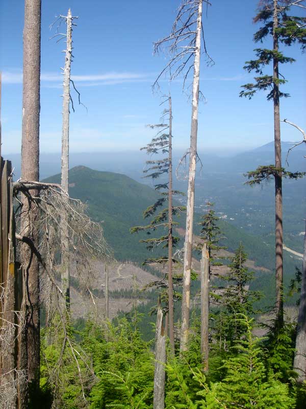
In the morning I inventoried my snacks and found a stop at the Index general store a necessity – I waited until they opened. Armed with two guidebooks and a Forest Service map I expected no difficulties in route finding. Two hours later, after a hike up an abandoned logging road, 4-wheeling through clearcuts, and returning to the main road to reset my odometer I parked at the slight pulloff indicating the West Ridge trail. I hiked straight up through brushy clearcuts and tree farms in midday heat. Seems to be my standard story for approaches these days. All the while the hum of harvesting machinery and the beeps of loaders sounded from below. The patchwork of treeless swaths and access roads became sickly apparent as I climbed up onto the flanks of Persis. The valley below me, intermixed Forest Service and Weyhauser land, looked strained and denuded – resource extraction from the tallest ridges to the lowest basins superimposed an unnatural and angular infrastructure on the land. I climbed steeply, hoping to the leave the noise and emptyness behind.
![]() I gained a ridge and tall timber. I came across two small lakes after 2500 feet of ascending in less that two miles. After the lakes the trail was distinctly alpine in nature. As I made my way across talus and heather towards the summit clouds began to swirl up to me from below and Mount Index began to show its mighty buttresses and gullies. From the summit of Persis an impressive view of Mount Index is gained – one I will not soon forget.
I gained a ridge and tall timber. I came across two small lakes after 2500 feet of ascending in less that two miles. After the lakes the trail was distinctly alpine in nature. As I made my way across talus and heather towards the summit clouds began to swirl up to me from below and Mount Index began to show its mighty buttresses and gullies. From the summit of Persis an impressive view of Mount Index is gained – one I will not soon forget.
No comments:
Post a Comment